Supercell Thunderstorms: Nature's Ultimate Storm Machine
Advertisement
2. The Perfect Storm: Conditions for Supercell Formation

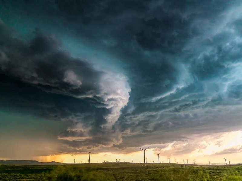
Nature's ideal storm, supercell thunderstorms depend on particular atmospheric circumstances for development and existence. For meteorologists and scientists studying these strong weather systems, knowledge of these conditions is absolutely essential since it enables improved prediction and preparation against possible severe storm events. A supercell is the result of a delicate equilibrium of temperature, moisture, and wind patterns coming together in just the correct way to produce these amazing storms that may occupy the landscape for hours.
A major component of supercell development is atmospheric instability. This happens when the warm, wet air close to ground differs significantly in temperature from the cooler air overhead. The warm air rises and keeps accelerating to produce the strong updrafts unique to supercells. A "cap," a layer of warm air aloft first keeps the surface air from ascending, therefore aggravating this instability. Once this cap is at last broken, pent-up energy in the atmosphere will be released and a large supercell will spawn from this violent thunderstorm development.
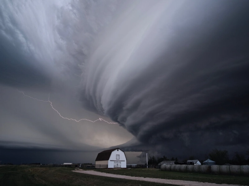
Wind shear—the variation in wind speed and direction with height—is another essential component in supercell development. Strong wind shear can cause the thunderstorm to rotate as required for supercell development and aid to organise it. Strong updrafts combined with wind shear produce the revolving updraft, sometimes known as mesocyclone, that defines a supercell thunderstorm. Unlike other kinds of thunderstorms, which usually fade more rapidly, this rotation is what lets the storm grow so well-organised and long-lived.
Supercell development also depends on moisture, which supplies the gasoline the storm requires to develop and get stronger. Usually collected from a vast area, a rich supply of warm, moist air near the surface is pulled into the storm from a distance—sometimes hundreds of miles before it enters the supercell. The lifting of this moist air causes condensation and latent heat release, which drives the storm's updrafts even more and adds to its general energy and intensity. Supercells are a constant threat to any place in their path since their continuous source of moisture lets them survive for long times.
Strong jet stream presence at upper regions of the atmosphere can also help to create supercells. This fast-moving river of air might improve the wind shear and give the storm's rising air extra lift. Further contributing to the organisation and intensity of the storm is the influence of the jet stream on the updraft and generation of the required conditions for rotation. For meteorologists trying to project the possibility for supercell development and the related hazards of severe weather, an awareness of the function of these broad atmospheric features is very vital.
Geographical elements also influence supercell formation; some areas are more likely to see these strong storms. Often referred to as "Tornado Alley," the Great Plains of the United States are especially vulnerable to supercell development because of their unusual mix of topography and climatic circumstances. Supercell development in this area is perfect when warm, moist air from the Gulf of Mexico clashes with cooler, drier air from the Rocky Mountains. Supercells, however, can arise anywhere in the world when the required atmospheric components gather—including portions of Europe, Australia, and South America.
Advertisement
Recommended Reading:
25 Hilarious Photos that Show the Funny Side of Women's Tennis →
You are viewing page 2 of this article. Please continue to page 3
Stay Updated
Actionable growth insights, once a week. No fluff, no spam—unsubscribe anytime.
Advertisement
You May Like

Owners Were Shocked! The Amazing Changes After Pet Grooming
08/26/2025

Supercell Thunderstorms: Nature's Ultimate Storm Machine
07/20/2025

Experience the Thrill of the World's Fastest 10 Cars
06/17/2025

21 Hotels That Can Make Anyone Want to Book the Next Flight
07/07/2025

DIY Disasters: When Repairs Go Horribly Wrong
07/22/2025

20 Luxurious Things From Dubai That Made Us Gasp
07/18/2025

16 World-Famous Lightning Landmarks: A Must-Visit Pilgrimage
08/13/2025

Exotic Delights: 12 Perfect Tropical Fruits for Fruit Salads
07/14/2025

Debunking the 8-Glass Rule: What Experts Want You to Know
09/01/2025

Apricot Jam: The Taste of Summer Sunshine
07/04/2025

10 Unobvious Things to Do as Soon as You Enter Your Hotel Room
06/13/2025

Wardrobe Woes: Hilarious Celebrity Outfit Blunders You Can't Unsee
07/02/2025

Rare Historical Photos That Reveal the Unknown Past
08/26/2025

Nature's Perfect Timing: 15 Mind-Blowing Animal Photos You Can't Miss
08/08/2025

10 Incredible Cities That Have Changed Beyond Recognition
06/05/2025

Hair Mistakes That Make Women Look Much Older Than They Are
07/29/2025

The Best Shot Of A Wild Animal You've Never Seen Before
08/19/2025

24 Pets Who Are Evolving Into Their Humans
06/11/2025

The Strangest Beauty Pageants Through History
07/28/2025

9 Amazing Facts About The Blue Lagoon - #6 Will Shock Even Icelanders!
08/16/2025

25 Hilarious Photos that Show the Funny Side of Women's Tennis
08/30/2025

The Surprising Benefits of Sleeping Next to a Lemon
08/05/2025

19 Reddit Users Shared Their Best Secrets to Make Life Easier at Home
07/19/2025

Underground Monsters: The Insane Depths of Earth's Deepest Mines Revealed
07/06/2025
Comments
JadeNomad · 08/07/2025
Signals disciplined thinking.
ZephyrTactician · 08/20/2025
Safeguards against drift inflation.